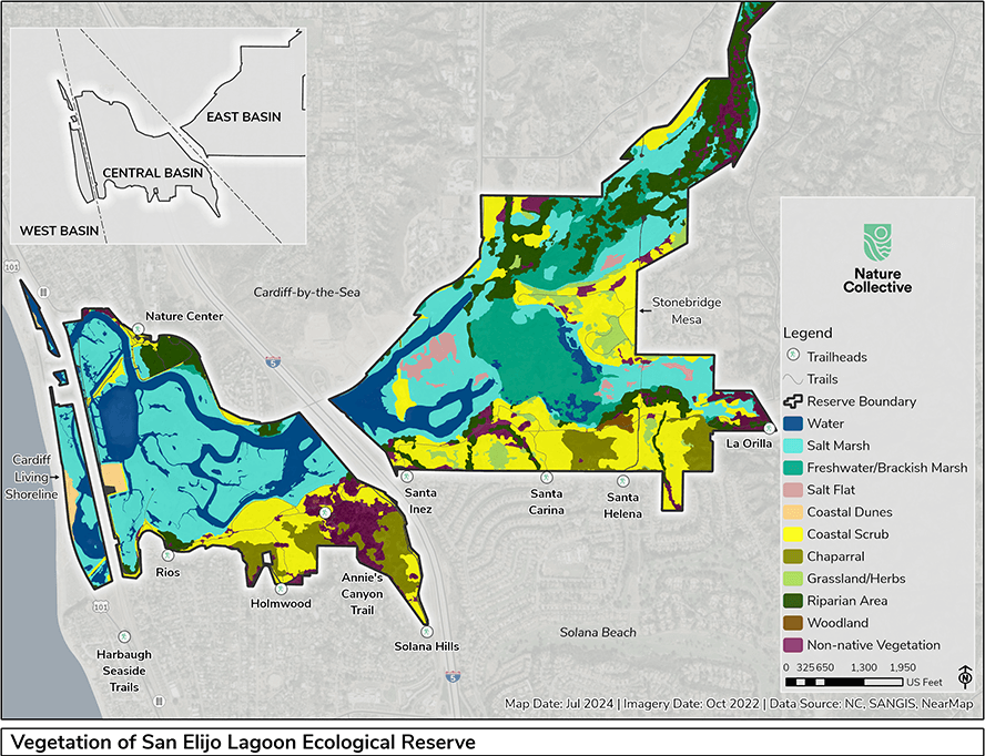
Vegetation mapping has evolved define co-occurring groups of species on a local scale.557, 558 Detailed vegetation mapping of San Elijo Lagoon and portions of Escondido Creek was conducted by the Nature Collective in 2022 and 2023. This was based upon recent classification systems,9, 559, 560 and it defined 31 vegetation “communities” and 71 associated “types”. These maps allow us to recognize and protect sensitive plants and vegetations, to monitor recovery of our restored areas, to identify areas for future restoration and to follow vegetation changes in response to changes in climate.
San Elijo Lagoon Ecological Reserve is centered on an estuary. At the west end, ocean water comes in and out with the tides. At the eastern end, fresh water is introduced by Escondido and La Orilla Creeks according to the weather, the season and the upstream activities of humans. Our vegetation types are determined by the interactions of these variable input forces. The results of the Nature Collective study are too detailed for this Plant Guide. Instead, we have condensed much of the small-scale variability of of the Reserve into fewer, more general categories, which are described below.